This is changing. Recently, the MROSD (the local open space district who owns the land) has been pushing forward a project to open it up. Demolition of the old air force station buildings has been completed, and they are actively working on building a new trail. However, at last check, it looked like the earliest the general public can get up there is still a few years off, in 2017.
Grrr. I really really really want to ride my bike up there. One can ride up neighboring Mt. El Sombroso and look toward Umunhum, and one can ride up Mt. Umunhum road to a similar elevation (about 3000 ft), but those last 400 ft of elevation just aren't allowed. Frustrating.

view of Umunhum from El Sombroso earlier this month
As we drove up, we went through several gates


and up to the top. The old radar tower is the last building standing while they decide what to do with it, as there is a debate between those who want to restore the site completely to its natural state, and those (including me) who see it as both a landmark and an interesting historic site.

From below, the old radar edifice looks like a cube; I was surprised to see that it is actually quite rectangular.
Despite the fog, the views all around were pretty amazing. One really feels on top of the world. What made it even more entertaining is the fact that I've poked around so much of the area by bike, and seeing familiar places from this different vantage point was pretty cool.
View down towards San Jose with Mt. Hamilton on the horizon

View down onto Mt. El Sombroso. Those dirt roads you see don't look so steep, but trust me, they are!

View looking down the ridge that Soda Springs Road comes up. This road would connect in if it weren't for some private property.

View off towards Monterey. You can just make out the ridge that curves around Monterey Bay over the edge of the fog. This area is apparently where the old commissary, bowling alley, and other service buildings were. Not a bad place to be stationed, I would think!

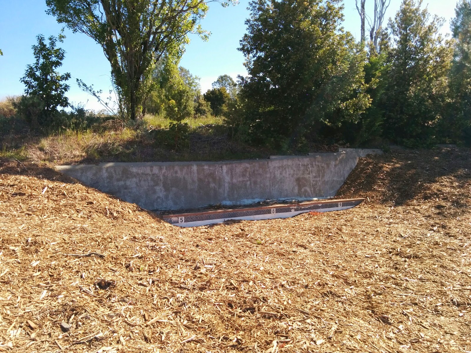
A piece of the old swimming pool. This was the only remnant left of all the buildings that used to be here, aside from the cube itself. I do hope that there is eventually some interpretive material with the history of the site put up here, for the benefit of those not lucky enough to explore with a knowledgeable ranger.
In case you are wondering, all the wood chips on the ground are remnants of the old buildings that they shredded and scattered to decompose. You can't really tell from the photos, but little plants and wildflowers are already starting to poke through the chips even just a few months after demolition, so I suspect it won't take long to start looking like a more natural surface.
Damage to the tower from the 1989 Loma Prieta earthquake. Given solidity of the building, it must have shaken pretty hard up here. Of course, it's also quite close to where the epicenter was.

After exploring the top of the mountain, I got to walk the portion of the new trail that is currently under construction since the ranger wanted to see how it was progressing.

It's just a lovely trail so far, well-graded with good sight lines, gently switchbacking up the mountain under the edge of the tree canopy. I would not have thought that one could route a trail up this peak that was mostly shaded, but they seem to be managing it! And the grade is really quite reasonable, especially given the ruggedness of the surrounding terrain. It's clearly a lot of work to put in, so I can see why they think it may be a while before it is all ready for use.
Another nice feature of the trail is that there are many and varied views of the summit as you ascend. I can't until they finish the whole thing. It's supposed to be a multi-use trail, and the nice routing they are choosing is not so evil that Nim couldn't ride it too :)

Wait, wait, wait. Once they open this first trail, there will be more wait, wait waiting for connections to be made to locations on the other side so one can make loops-- but at least it appears that things are moving in the right direction!
No comments:
Post a Comment